

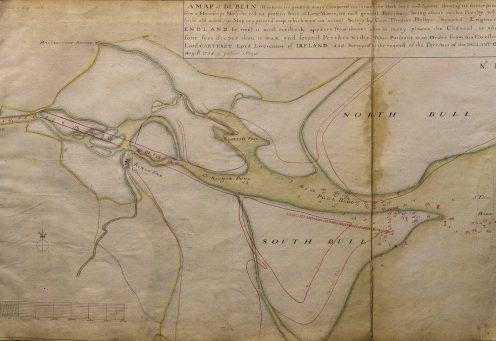
In 1762, George Semple presented seven charts to the Ballast Office. The charts were not a commission, but instead they can be described as a portfolio. Dublin Port was at the early stages of its development, with the Great South Wall still under construction.
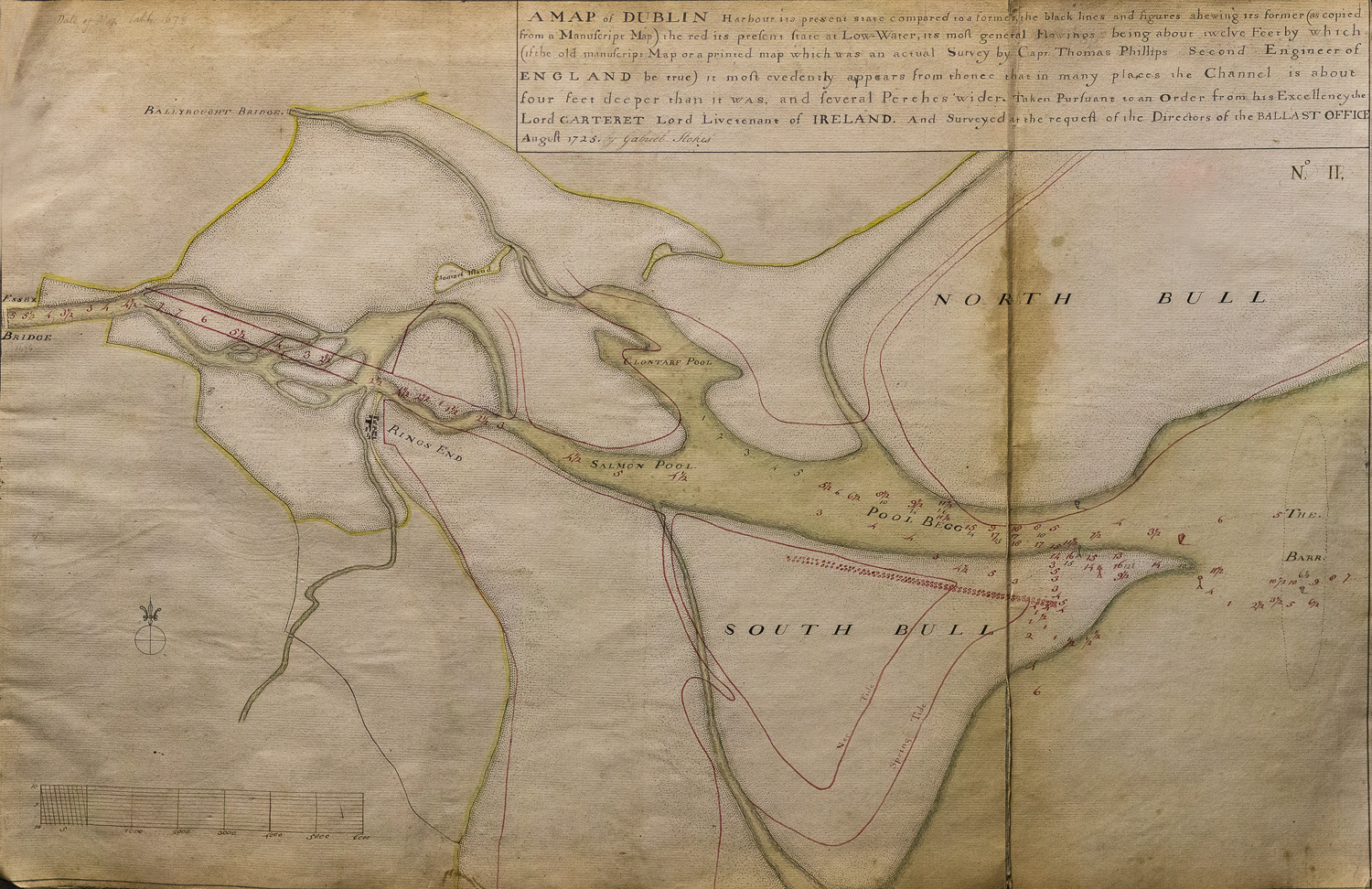
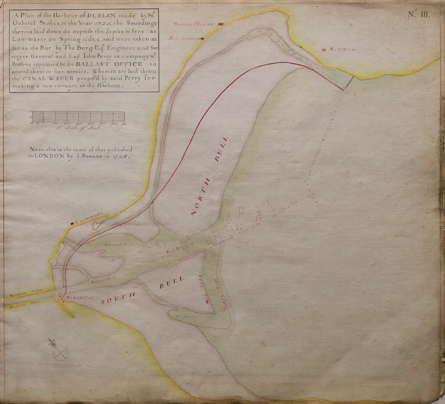
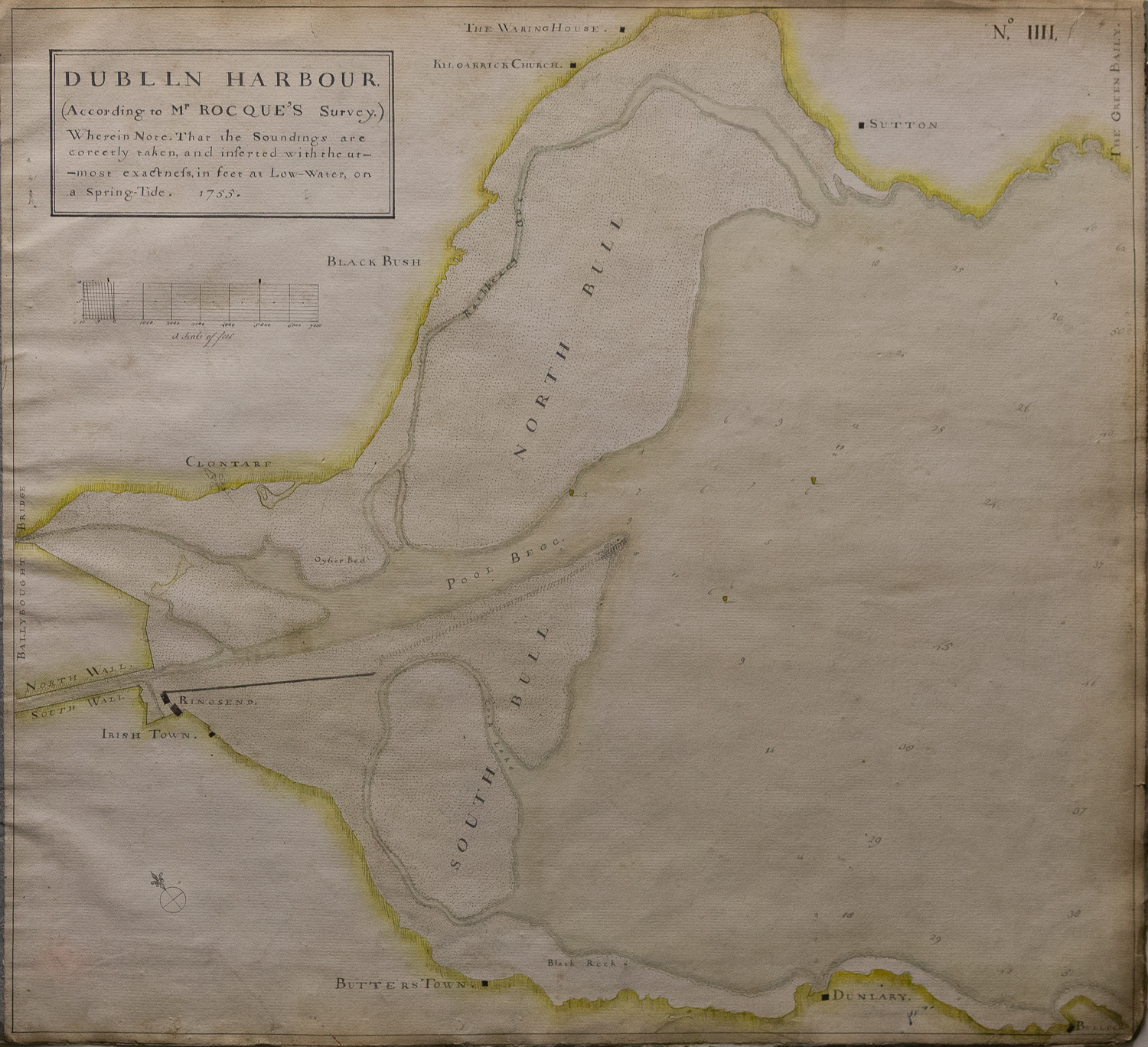
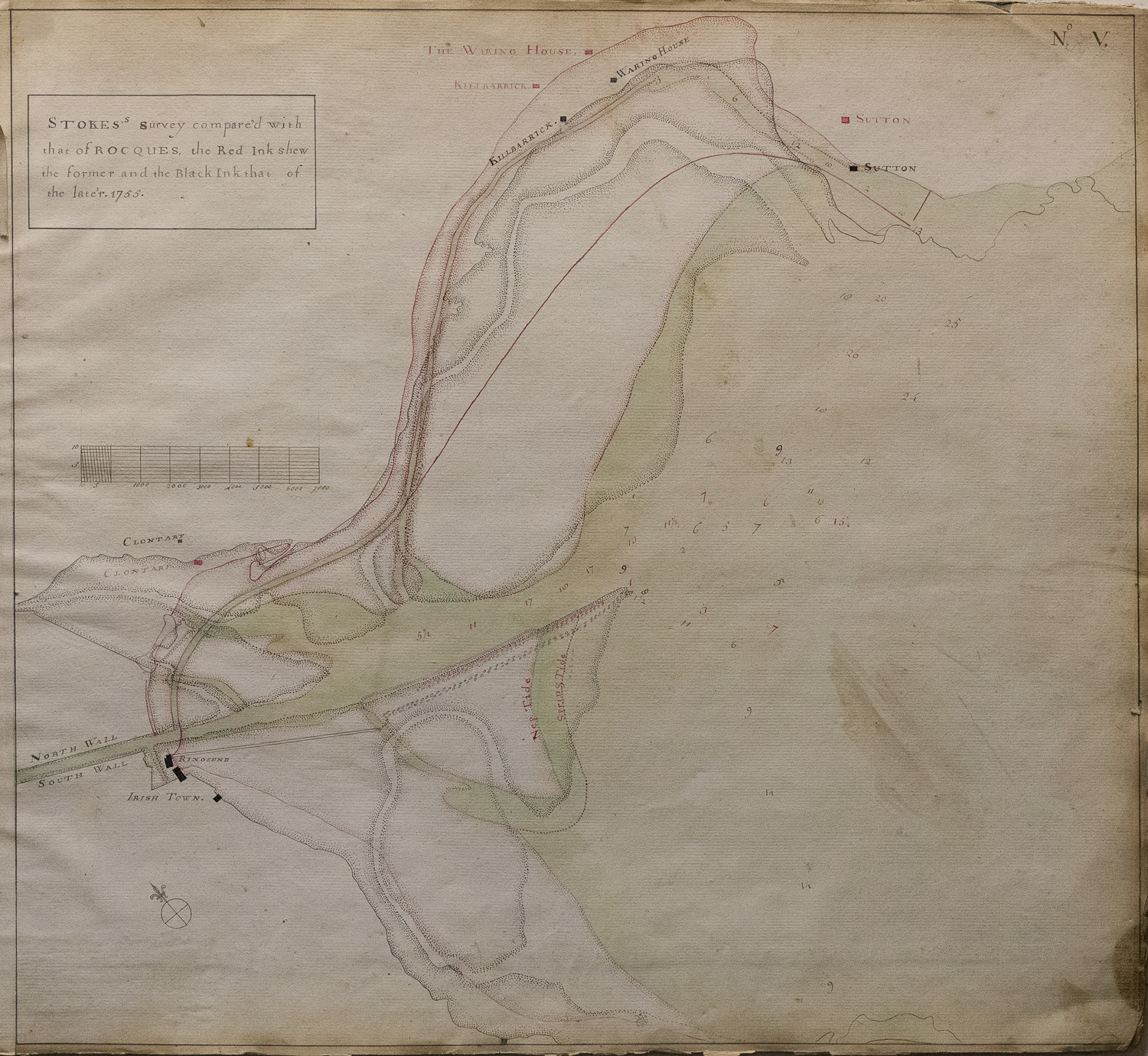
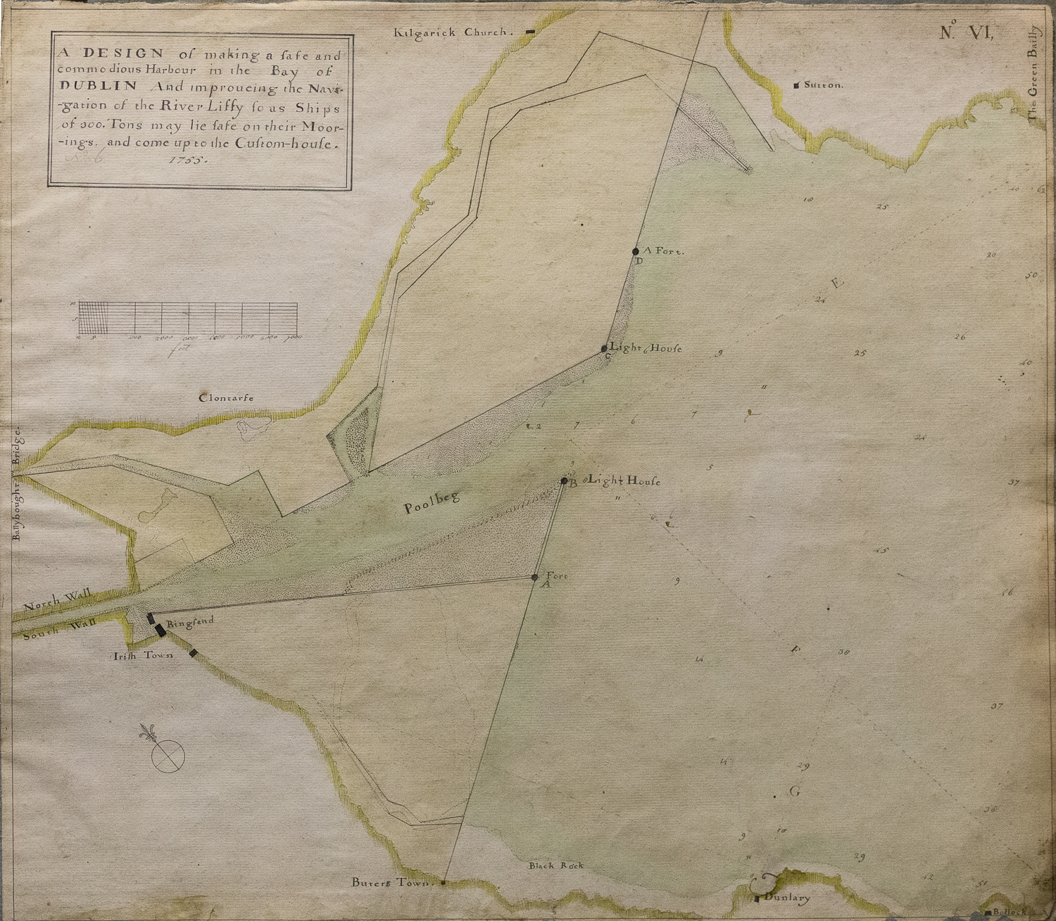
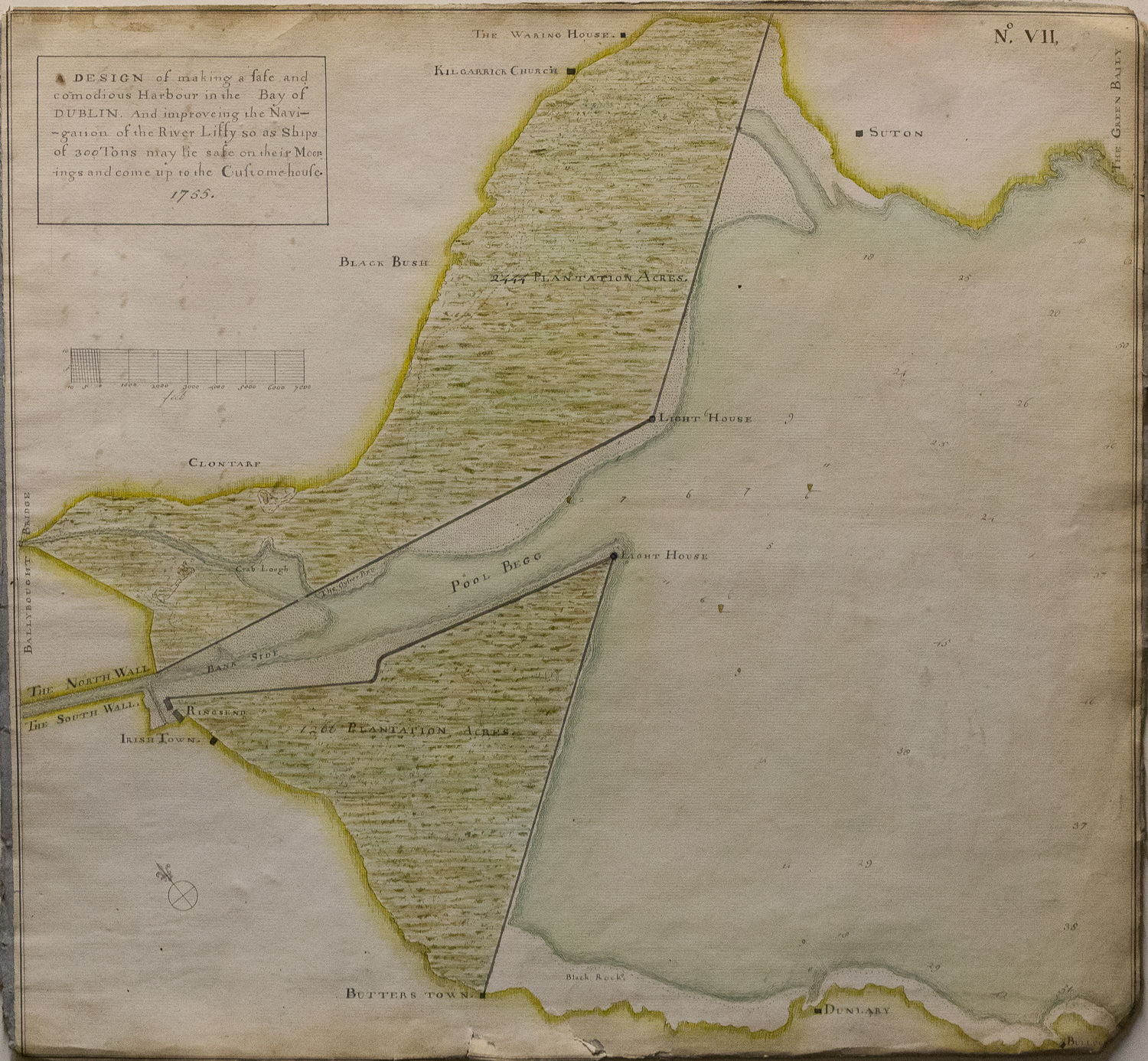
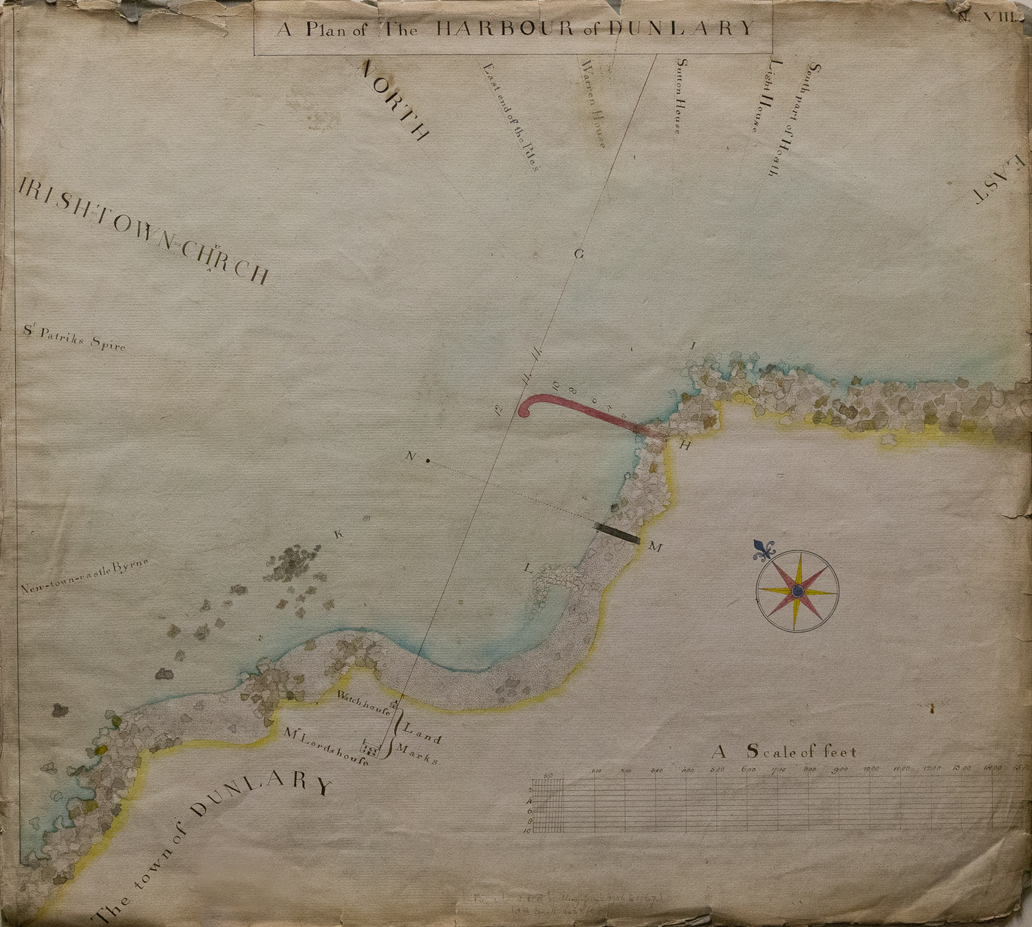


The Ballast Office, as the first authority, had taken action to improve the navigability of Dublin Bay. Heavy winds and quick sand rendered sailor’s experience and their skills useless. Indeed, according to the municipal archives, the north and south bulls turned into the graves of thousands. Semple intended to show his vision to the committee on how Dublin port should be further designed and developed. Out of the 8 charts, only 2 show his proposal, with four depicting the evolution of the Port until 1762 by overlaying the outline of earlier maps. Semple was the first person (at least in Ireland) to apply this method of overlaying charts to the Dublin Bay area to show the outcome of civil engineering works over a long period.
Related Articles


Help us with the Archive
You can help us to preserve Dublin Port’s rich archival heritage by
donating items or seek advice from us on items in your safekeeping.
Get in touch by completing the contact form below.
We’d love to hear from you!
